


For many years now there have been spasmodic indications from our local council, now subsumed in the unitary authority called Buckinghamshire Council, of a desire to de-culvert a section of the river Wye as it passes beneath the centre of Wycombe.
If my recollection is correct this started when it was found that the elevated section of the inner relief road was deteriorating faster than expected and would need either:
- the support structure to be repaired and strengthened, or
- the dual carriageway to be demolished, and the road re-routed
The thinking was that the latter course of action would provide a wonderful opportunity to unite the two sections of the town either side of the road and at the same time open up a section of the river.
At first, Planning Inspectors were doubtful but once the county and district councils had worked together to show that an alternative route around the town centre could work (it has now mostly been built!), they accepted it and the vision is now included in the Wycombe District Local Plan.
Whilst the best way to proceed was considered, our local council decided quite reasonably that the traffic-load on the elevated section must be reduced. This was achieved by reducing the east-bound carriageway to one lane, by blocking off the inside lane. As so often can happen, let us hope that this temporary measure does not become the permanent solution.
The river Wye
The Wye is what is known as a chalk stream, one of the most important in the Chilterns. These are a globally rare habitats which supports a wide variety of wildlife, including some of the UK’s most endangered species. Eighty-five percent of all chalk streams are to be found in England.
The river flows for about 10.5 miles (17km) from West Wycombe through High Wycombe, Loudwater and Wooburn Green to join with the River Thames at Bourne End.
It is fed from freshwater springs that rise up through the Chiltern chalk.
The source of the Wye varies from year to year, which is a characteristic of chalk streams.
Before the river disappeared
From time immemorial the river has flowed through the settlement, then town, of High Wycombe. For centuries it would have been the embodiment of the “Fountain of Life” for the local inhabitants.
As the town developed, it was necessary for new thoroughfares to cross the river. Bridges were built, no doubt mostly simple structures to begin with, which needed improvements over time.
For example, Newland Bridge which connected the area west of the town centre known as Newland to White Hart St, underwent major reconstruction work in the 1910s.
The first time that a section of the river was banished underground was in 1936/37 when a short stretch was culverted beneath London Rd in Wycombe Marsh.
It was probably a year or two before that, that the fate of the river was sealed. In 1935 the demolition of large parts of the area known as Newland were started, in readiness for redevelopment.
By the time the bulldozers began their work, Newland can only be described as being a slum area.
That area, immediately to the west and south of the old boundary of the Borough of High Wycombe, was originally nothing more than a flood plain for the river.
Marshland, with streamlets flowing hither and thither, into the river. Then the area was drained and reclaimed to allow the town to expand westwards south of the river.
At that time there was very little control over how development should take place, so Newland became a juxtaposition of tenements and chair-making factories.
The river became a dumping place for all sorts of waste and rubbish. Not exactly an asset to the town.
Culverting is agreed, upon and extended
Before the redevelopment of the Newland clearance area could begin WW2 intervened.
The war from 1939 to 1945 was followed by a period when the country was simply getting back on its feet.
So it was not for some years after the war that the authorities in Wycombe could begin to consider the regeneration of the town, although some demolition was carried out to prepare for redevelopment.
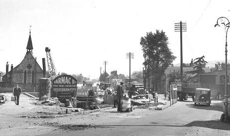
In 1957/58 extensive demolition was carried out in the Brook St and Westbourne St areas on the south side of the Oxford Road.
It was then at a quarterly meeting of the town council on February 17 1959 that the following minute was agreed “Your [planning] committee have considered a report upon the question of widening Oxford Road, and to enable redevelopment to be carried out at the appropriate time it would appear essential for the length of the River Wye between Brook Street and Westbourne St to be culverted in the immediate future.”
So it was to allow a road to be widened, albeit an important thoroughfare on the western side of the town, that the decision to bury the river was first taken. Although the public were allowed to attend the meeting, there was no opposition expressed to the decision.
One councillor did ask if a suggestion that the river could be kept as an attractive feature between the up- and down-lanes of the road had been considered.
To which another councillor dismissively replied “How many motorists would find it an attractive feature in the middle of the road on a foggy night like this!"
There was only one Letter to the Editor about this issue sent to the Bucks Free Press, an oft-used way for the public to comment on council affairs.
The letter simply applauded the decision and stated that “the river is in such a revolting state, bright green and strewn with garbage and old boots and discarded utensils, that covering it up is the best solution.”
So it seems that at that time the Wye was a dirty, forgotten river and there was little sorrow that a section was to be banished underground.
Although that was only a short stretch of the river of some fifty metres, the principle of culverting it had been established without significant public opposition.
That seems to have provided the catalyst for the much more extensive culverting of the river which took place from 1965 to 1967.
This was to allow the major redevelopment of the town which took place in the late 1960s culminating in the Octagon shopping centre, now subsumed in Eden, which was formally opened on October 6 1970.
Where is the river now?
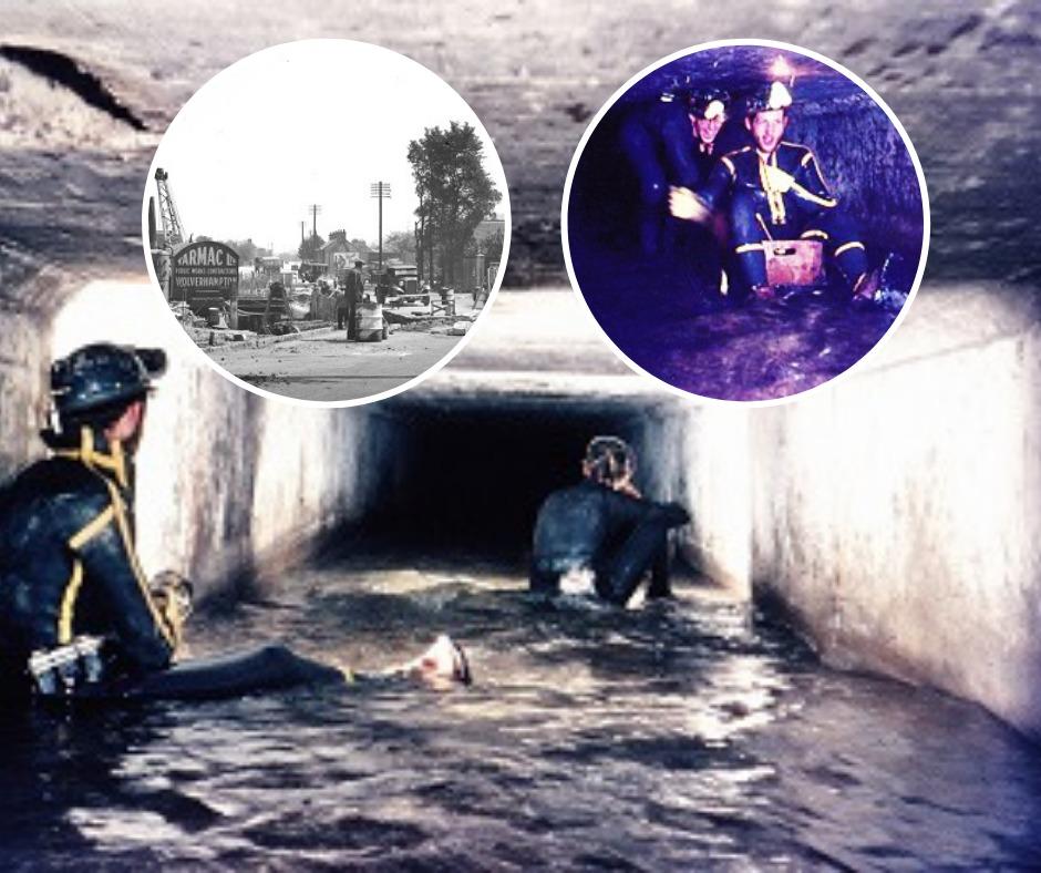
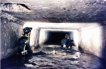
The river Wye now flows below Oxford Road between Westbourne Street and the Archway Roundabout and then below the Abbey Way flyover until it emerges between the former British Legion building and The Swan car park and theatre. The culvert consists of two tunnels which are connected by small cross openings.
Not long after the culverting was completed a small team of three intrepid potholers, David Byers, Malcolm and Brian Tilbury, explored the whole length. They entered the left-hand tunnel through the grill near Westbourne St, the left was chosen because most of the water was flowing down that side.
In the tunnel the team found a small wooden wheel barrow, which they left there, and a sledgehammer which they retrieved.
They left the tunnel via the exit near the British Legion building.
At that point, the tunnel had already silted up to a depth of about 1ft, which extended back for some 30 yards.
On their walk back through the town centre the team were stopped and questioned by a policeman as to what they were up to. He took some convincing about their conduct!
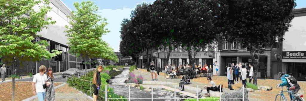
A campaign to restore the Wye
This week the Bucks Free Press has launched a campaign calling on the new councillors elected in Buckinghamshire to put reopening the River Wye to the top of the agenda.
For more information about the campaign, see page 3.
For more information about the River Wye:
Silt Road - the story of a Lost River, by Charles Rangeley-Wilson, is available at the library or consult the websites revivethewye.org.uk or highwycombesociety.org.uk


Comments: Our rules
We want our comments to be a lively and valuable part of our community - a place where readers can debate and engage with the most important local issues. The ability to comment on our stories is a privilege, not a right, however, and that privilege may be withdrawn if it is abused or misused.
Please report any comments that break our rules.
Read the rules hereLast Updated:
Report this comment Cancel